


Namibia, a vast and diverse country located in Southern Africa, is home to a range of geographical features, from arid deserts and mountainous regions to lush river valleys and coastal plains. While its stunning landscapes attract tourists from around the world, Namibia’s demographic landscape is just as fascinating. The way the country defines its enumeration areas—the smallest units used in population censuses and surveys—is critical in ensuring accurate and comprehensive data collection. The unique demarcation of these areas has important implications for national planning, resource allocation, and service delivery.
In this article, we will explore the concept of enumeration areas in Namibia, why they are critical for understanding the country’s population distribution, and how their unique features reflect Namibia’s complex geography and social dynamics. We will also examine the impact of these areas on Namibia’s census methodology, government policies, and the challenges the country faces in data collection.
What Are Enumeration Areas?
In census terminology, enumeration areas (EAs) refer to the smallest geographic units in which population data is collected. An EA typically includes a number of households within a defined boundary. During a national census, enumerators are assigned to these areas to collect demographic, economic, and social data from each household. The data collected within these areas forms the foundation for determining national and regional trends and informs the allocation of government resources.
In Namibia, the demarcation of enumeration areas takes into account a variety of factors, including:
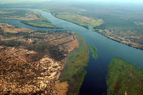
- Geography: The country’s diverse landscapes, ranging from deserts to wetlands, significantly influence how the areas are structured. Rural and urban areas are also distinguished, and the demarcation process accounts for factors like roads, rivers, and mountain ranges.
- Population Density: Namibia has a low population density, which influences how enumeration areas are divided. In rural areas, larger geographical areas might be included in a single EA, while urban centers with higher population densities are divided into smaller units.
- Infrastructure: The availability of roads, transport networks, and other infrastructure affects how enumeration areas are defined. Areas with limited infrastructure may present challenges for enumerators trying to access remote communities.
- Cultural and Administrative Boundaries: Namibia’s ethnic diversity and the presence of various traditional authority structures require careful consideration in the demarcation process. Tribal boundaries, administrative regions, and local governance structures can play a role in how areas are grouped.
The Importance of Proper Demarcation in Namibia
In a country like Namibia, which has one of the lowest population densities in the world, proper demarcation of enumeration areas is essential for the following reasons:
- Accurate Data Collection: To ensure that every individual is counted, enumeration areas must be clearly defined and easy to access. Without proper demarcation, enumerators might miss remote communities or fail to gather data from certain population segments.
- Targeted Resource Allocation: Accurate data from each enumeration area allows the government to allocate resources where they are needed most. This includes everything from healthcare services to education and infrastructure development. Understanding the number of people in each area helps determine where investments are most crucial.
- Urban and Rural Planning: Namibia’s unique mix of rural and urban areas requires different approaches to development. The demarcation of enumeration areas helps officials understand the challenges of each region and craft appropriate policies for urbanization, rural development, and poverty reduction.
- Election and Governance: Demarcation is also important for electoral purposes, as it defines constituency boundaries for local government elections and parliamentary elections. It ensures that representation is fair and that every community is accurately represented in the country’s political system.
- Crisis Management and Aid Distribution: In times of disaster, conflict, or crisis, knowing the exact population in each area is critical for effective response. Whether it is delivering aid during droughts or providing health services during an outbreak, enumeration areas help determine where to direct resources quickly and efficiently.
Historical Context: The Evolution of Enumeration Areas in Namibia
Namibia’s census history and its approach to demarcating enumeration areas have evolved significantly since the country gained independence in 1990. Prior to independence, Namibia was under South African administration and, later, German colonial rule. During these periods, the focus of census-taking and data collection was on serving the needs of the colonial government, often at the expense of the indigenous populations.
- Pre-Independence: Under colonial rule, censuses were often used for controlling populations, managing resources, and maintaining authority. The structure of enumeration areas was largely shaped by administrative divisions that separated indigenous communities from European settlers. This period was marked by the segregation of population groups, with African communities often residing in poorly defined rural areas far from urban centers.
- Post-Independence: After gaining independence in 1990, Namibia set out to create a more inclusive and representative census system. The country moved toward a more democratic and equitable approach to population counting, ensuring that all Namibians, regardless of ethnicity or geographic location, were properly represented in census data. This shift led to the introduction of a modernized census methodology with a greater focus on rural areas, informal settlements, and cross-border populations.
- The 2001 and 2011 Censuses: With the rise of technological advancements and better access to data collection tools, the 2001 and 2011 censuses marked a turning point in Namibia’s approach to population data collection. The country began to make greater use of electronic devices and satellite imagery to define and map enumeration areas, particularly in remote regions. These efforts aimed to address logistical challenges related to Namibia’s sparse population, seasonal migration, and nomadic communities.
- The 2021 Census: The most recent census, conducted in 2021-2022, employed the De Facto Census Method and took advantage of advanced geospatial technology. Enumeration areas were updated and more precisely defined using GIS mapping tools, which allowed for more accurate data collection in Namibia’s most remote corners. With mobile technology and real-time data processing, the census was able to cover previously inaccessible regions, particularly in the Kaokoveld and Kavango regions.
Challenges of Demarcation in Namibia
Despite advancements in technology and improved methodologies, there are several challenges in demarcating enumeration areas in Namibia. These challenges arise from the country’s geographic, social, and economic realities.
- Geographical Barriers: Namibia is known for its vast and rugged landscapes, including deserts, mountains, and river valleys. This makes physical access to certain areas difficult for enumerators, especially in remote areas with poor infrastructure. Roads in rural regions can be impassable during the rainy season, and some communities are isolated for large parts of the year.
- Diverse Population and Migration: Namibia is a multicultural country, home to over 10 different ethnic groups, each with unique cultural and traditional practices. Migration, whether seasonal or cross-border, further complicates the enumeration process. Populations in border regions, such as those in Zambezi, Kavango, and Ohangwena, experience frequent movement due to work, family ties, or political instability, making it hard to pin down an exact count of people in these areas.
- Urbanization: The rapid growth of urban centers like Windhoek, Swakopmund, and Walvis Bay presents its own set of challenges. These cities are constantly expanding, with informal settlements sprouting up in areas that may not be clearly demarcated as urban spaces. As a result, enumerators must be diligent in tracking changes in population density and ensuring that all informal settlements are counted.
- Resource Limitations: Despite technological advancements, financial and human resources remain a constraint. Namibia’s census efforts rely heavily on government funding and external support. Inadequate resources can sometimes lead to delayed censuses or incomplete data collection in some regions.
The Role of Enumeration Areas in Namibia’s Development
The accurate demarcation of enumeration areas is a vital part of Namibia’s development planning. These areas provide essential data that help shape government strategies in the following ways:
- Infrastructure Development: Knowing the population size and distribution within enumeration areas allows the government to prioritize projects such as building roads, bridges, and schools, especially in rural and underserved regions.
- Healthcare Services: With accurate population data, the government can allocate healthcare resources more effectively, ensuring that hospitals, clinics, and vaccination programs are adequately staffed and equipped to serve the needs of all communities.
- Educational Opportunities: Census data helps identify areas where educational facilities are most needed, ensuring that children in both urban and rural regions have access to quality schooling.
- Social Welfare Programs: Proper demarcation aids in identifying regions that may require social assistance or poverty alleviation programs, ensuring a more equitable distribution of government support.
Namibia’s enumeration areas are not just statistical tools; they are a reflection of the country’s geographic diversity, social complexity, and commitment to accurate data collection. Through thoughtful demarcation, Namibia ensures that every individual is counted, and every community receives the resources and attention it needs. While challenges remain, particularly in remote and rural areas, the country continues to evolve its census methods to better capture the full scope of its population.
By continually refining the process of defining enumeration areas, Namibia is laying the foundation for more inclusive and effective development, contributing to its goals of sustainable growth, social equality, and nation-building. As Namibia moves forward, the
lessons learned from its unique census approach will undoubtedly influence not only the country’s future policies but also serve as a model for other nations facing similar demographic challenges.